November 6, 2019
The security division of Amper Sistemas has chosen CrossGeo .Server as GIS server for its emergency management system Nemesis Web. Nemesis is Amper’s multi-agency and distributed emergency management system. The system’s mission is to improve the decision-making process and reduce the response time of emergency bodies and services (police, health services and firefighters). It manages the entire life cycle of incidents quickly and easily, from reception to dispatch and closing.
CrossGeo .Server allows Amper to offer a complete solution that includes map services, route analysis and direct and reverse geocoding.
July 17, 2019
The 2019.0 release of CrossGeo .Net and CrossGeo Studio is now available with new features and important improvements:
Feel free to contact us to request a demonstration.

January 21, 2019
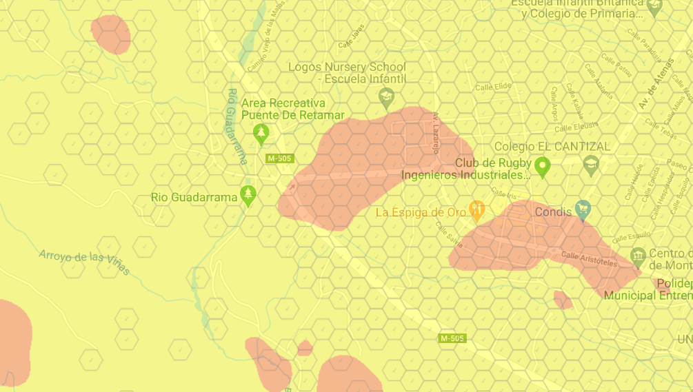
GPCON has integrated CrossGeo Server in the coverage map publishing system developed by Aptica. Through this system, Aptica offers a cloud coverage publishing service that is currently being used by several mobile telecommunications operators in Spain: Orange, Amena, Jazztel, Simyo y República Móvil.
CrossGeo .Server allows Aptica to offer a very reliable solution, with 24/7 availability and high performance.
October 8, 2018
CrossGeo Server supports WMS and WMTS map standards, which makes it compatible with most commercial and open source GIS software products.
CrossGeo Server is built on top of CrossGeo .Net core, so that all the power, flexibility and performance of CrossGeo .Net is transferred to the server environment.
CrossGeo Server can be deployed both on a personal and on a cluster computer for high availability and/or scalability. It is designed and highly optimized to take advantage of multicore architectures in modern processors.
Design your maps with CrossGeo Studio, combining multiple data sources and customizing every single layer. Use CrossGeo symbolization capabilities to design complex maps with high quality rendering and share easily on the web with CrossGeo Server.

September 3, 2018
The 2018.0 release of CrossGeo .Net and CrossGeo Studio is now available with new features and remarkable improvements:
Feel free to contact us to request a demonstration.
August 26, 2018
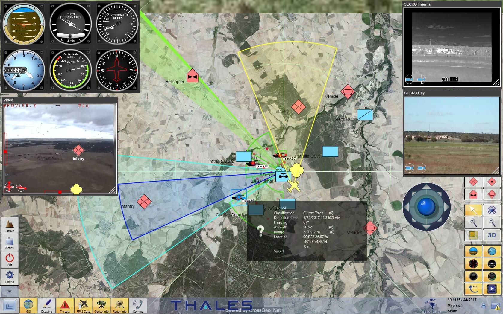
Thales Programas relies on CrossGeo .Net to integrate the geospatial component into its system HORUS.
HORUS X is designed to provide the user with information obtained from the connected sensors, external information sources like AIS for ships or ADS-B for airplanes and Command and Control systems.
Main applications of HORUS:
CrossGeo .Net provides a set of software components for the development of GIS applications in .Net, including WPF controls and Windows Forms for viewing 2D and 3D maps. The high performance of CrossGeo .Net makes it particularly suitable for real-time and mission critical systems.
September 26, 2017
For another year the Geographic Center in the Army relies on GPCON to maintain the Military Geographic Information System and the main application Carta Digital for Windows and Android.
Part of the GPCON company members have lead SIGMIL project management from the beginning in 1998, starting with GISET project and continuing uninterruptedly with SIGMIL, SIGEOCAR and SIGMIL Expansion projects until 2007. Additionally GPCON has actively participated in the maintenance of SIGMIL projects during 2010-2012, 2014 and 2016.
September 18, 2017
The 2017.0 release of CrossGeo products is now available: CrossGeo .Net, CrossGeo Studio and CrossGeo Touch.
CrossGeo .Net provides a set of software components for the development of GIS applications in .Net, including WPF controls and Windows Forms for viewing 2D and 3D maps. In this new release it is worth noting the new Full Motion Imagery module which allows a video source to be projected in real time on the ground. Video sources must contain metadata according to the MISB-ST-0601 or STANAG 4609 standards.
CrossGeo Studio is a desktop application that allows you to design the maps that can be later used in applications developed with CrossGeo .Net. The new release incorporates the support of new CrossGeo .Net data sources and new styles for symbolizing vector layers.
CrossGeo Touch allows the development of native apps for the visualization of Geographic Information. In addition to online map services, CrossGeo Touch allows the visualization of geographic information stored locally in fully disconnected mode.

February 21, 2017
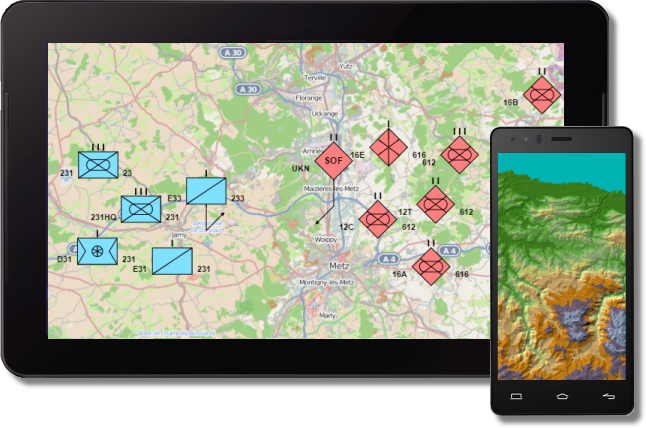
The security division of Amper Sistemas has chosen CrossGeo .Net for Nemesis emergency management system. Nemesis is Amper’s multi-agency and distributed emergency management system. The system’s mission is to improve the decision-making process and reduce the response time of emergency bodies and services (police, health services and firefighters). It manages the entire life cycle of incidents quickly and easily, from reception to dispatch and closing.
CrossGeo .Net provides a set of software components for the development of GIS applications in .Net, including WPF components and Windows Forms for viewing 2D and 3D maps. With the simple and intuitive API can obtain surprising results in a very short time.
November 7, 2016
The objective of the project is the evolution and maintenance of SIGMIL libraries and the main application Carta Digital, both the PC and the Android version, to solve the new requirements and needs from different users of the Army.
Part of the company team has lead SIGMIL project management from the beginning in 1998, starting with GISET project and continuing uninterruptedly with SIGMIL, SIGEOCAR and SIGMIL Expansion projects until 2007. Additionally GPCON has actively participated in the maintenance of SIGMIL projects during 2010-2012 and 2014.
October 25, 2016
Now available a new release of the CrossGeo family products for Windows. This new version incorporates access to new online map services (Carto©, ArcGIS© REST Services and XYZ tile servers), new capabilities of graphic objects and vector features symbolization, a new inverse and direct geocoding module and remarkable improvements in performance.
December 1, 2014
With the release of CrossGeo Touch, GPCON expands the development capabilities of CrossGeo suite, now also supporting Android 4.0 or higher mobile devices.
CrossGeo Touch allows you to build native apps for displaying geographic information. In addition to online mapping services, CrossGeo Touch allows visualization of geographic information stored locally on totally disconnected mode.
With CrossGeo Studio you can prepare the maps which can then be easily loaded from your CrossGeo based applications.
September 15, 2014
CrossGeo .Net provides a set of software components for rapid development of GIS applications in .Net, including WPF and Windows Forms controls for displaying 2D and 3D maps. Its simple and intuitive API gets you up and running quickly.
The flexibility of its API allows you to develop applications for a wide range of sectors: Defense, Security, Geo-Marketing... Its high performance makes it particularly suitable for real time and mission-critical systems.
CrossGeo Studio is a Windows desktop application that allows you to prepare the maps that can be used from your CrossGeo based applications.
August 27, 2014
The maintenance contract for this year includes two large blocks of functionality. The first block includes a number of improvements in SIGMIL and Carta Digital to increase their functionalities and improve usability. The second one includes the development of a map viewer for Android mobile devices.
The Android app allows you to visualize raster data stored on the device, geolocate the user with the coordinates obtained from the device positioning system, navigate routes and capture basic navigation data. The application will be designed to work completely in offline mode, although, when there is a network connection available, the application will offer some additional capabilities such as access to online map services.
November 5, 2013
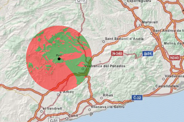
GPCON presented a paper entitled "Xirio-Online: An example of GIS cloud service". Xirio-Online is a radio planning tool based on a web architecture with civilian and military applications. This tool has been developed to Aptica in a joint project launched in 2008. It allows to calculate the coverage and interference of most radio services from GIS data sources such as terrain models, demography, morphography ... The paper described the tool and the advantages and disadvantages of its implementation as a web application.