Innovative solutions for the treatment and exploitation of Geographic Information

Company

GPCON is a IT company integrated by highly qualified professionals with many years of experience in Geographic Information Systems (GIS).


Read more »

Services

IT Consulting, software development, training, technical support. The years of experience of our team allow us to offer the best technical solution to your needs.


Read more »

News

November 6, 2019.

Amper chooses CrossGeo Server for its emergency management system Nemesis Web.


All news »

Visualization and analysis of Geospatial Information in your Windows and Android applications with our cross-platform product suite

CrossGeo

CrossGeo .Net

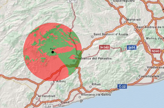
Build applications for visualization and analysis of geographic data in WPF or Windows Forms.

CrossGeo Touch

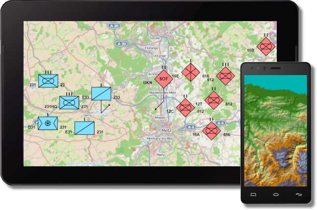
Build native apps in Android based devices to display on-line and off-line Geographic Information.

CrossGeo Studio

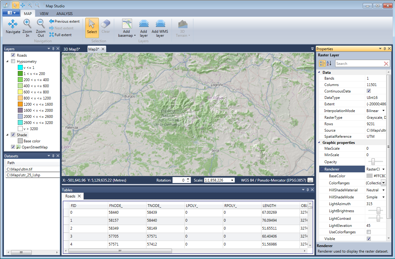
Design the background maps for your applications developed with CrossGeo .Net and CrossGeo Touch.

CrossGeo Server

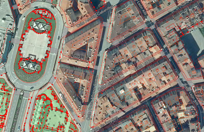
Publish your maps designed with CrossGeo Studio using OGC open standards.


Build Windows based Situational Awareness applications

CrossGeo .Net

Support for WPF and Windows Forms
CrossGeo .Net provides software components for rapid development of Situational Awareness systems in WPF and Windows Forms.

Access to cartographic data without preprocessing
Access dozens of raster and vector data sources in their original format without preprocessing.

Analysis tools
Line of sight, vertical terrain profile, routing, spatial filters, buffer zones...

Leveraging multi-core processors
CrossGeo .Net is designed to take advantage of modern multi-core processors. Rendering and processing tasks are performed in background keeping the user interface always responsive.
Read more »

Geospatial Information in Android based devices

CrossGeo Touch

Build native apps for Android devices
CrossGeo Touch allows rapid development of native apps for visualization and analysis of geographic information on Android mobile devices. Thanks to its simple and intuitive API you can display your data with very few lines of code.

Access to cartography
In addition to online map services, CrossGeo Touch allows visualization of geographic information stored locally on totally disconnected mode.

Leveraging multi-core processors
CrossGeo Touch is designed to take advantage of modern multi-core processors, while keeping low battery usage.

Read more »

Design the maps for your CrossGeo based applications

CrossGeo Studio

2D and 3D maps
With CrossGeo Studio you can design 2D and 3D maps which can then be loaded from your applications developed with CrossGeo .Net and CrossGeo Touch.

Multiple data sources
Combine different raster and vector data sources on a single map.

Layer customization
For each layer that make up the final map, you can customize all its properties to tailor its appearance to your needs: filter, opacity, symbols, data interpolation...
Read more »

Publish your geospatial data using OGC standards

CrossGeo Server

OGC standards support
CrossGeo Server allows you to publish your maps according to OGC WMS and WMTS open standards. This makes Crossgeo Server compatible with most commercial and open source GIS software products.

Map design
With CrossGeo Studio you can customize your maps by combining different raster and vector data sources on the same map and configuring all their graphic properties.

Routing and Geocoding services
CrossGeo Server provides a REST API for direct and reverse geocoding and for calculation of routes between two or more points.

Read more »

Our customers

The extensive experience of our technical team allows us to provide our customers with a high added value in the implementation of their projects, offering innovative quality solutions.